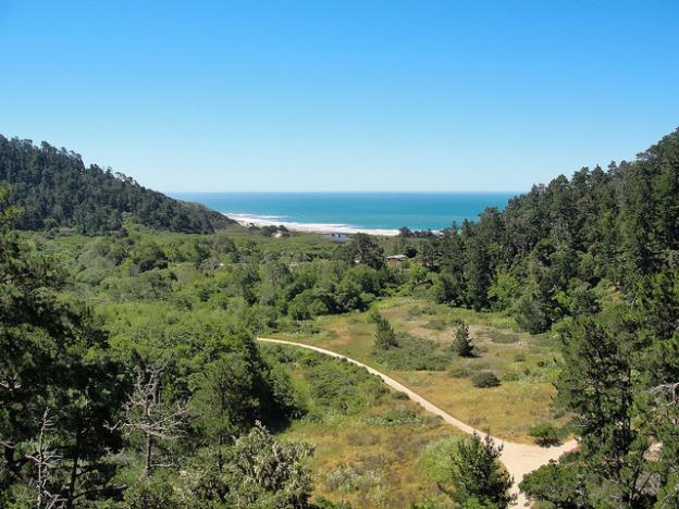
Waddell Beach from the Skyline-to-the-Sea Trail. Photo by Miguel Vieira/Flickr
In 1976 the Sempervirens Fund completed the Skyline-to-the-Sea Trail, a scenic 31-mile route from Castle Rock State Park to Waddell Beach via Big Basin State Park. The trail, which typically takes three days to hike, is known for its jaw-dropping ridgeline views and magnificent redwood groves. In early July, Ellen Holderman hiked the trail for the first time with her father, Sempervirens Fund executive director Reed Holderman. Following are excerpts from her account of the journey.
As we began our hike we entered a shaded forest with peek-a-boo views of the heavily forested Santa Cruz Mountains and those amazing climbing rocks at Castle Rock. As this was my first time backpacking the Skyline-to-the-Sea Trail, I was pretty excited to be completely surrounded by beautiful redwood trees.
The first stretch of the trail is via the Saratoga Toll Road, which is an old road from the 1900s—imagine horse-drawn carriages bumping along—that meanders back and forth on either side of Highway 9 with very clear and good trail markers. From this section of the trail we had incredible views of either the headwaters of Pescadero Creek or the San Lorenzo River that flows into the sea in Santa Cruz near the Beach Boardwalk.
After about five or six miles of some relatively easy up and down, we arrived at Waterman Gap—our first backcountry camp—and were pleased to see a water spigot and even a restroom! We set up at campsite #1. My dad had stayed at #7 before and recommended that one too. Both are nice, but I liked number 1, because it's below the main camp and tucked into a beautiful redwood grove not far from water. Also, there was a really cool redwood stump we used as our kitchen table and seating area.
The next day started with some yummy oatmeal, freeze-dried strawberries, and some yoga! (Well at least for me. I am not sure my dad does yoga, but I taught him a couple of positions anyway.) We headed off on the trail to Big Basin, which was a tiring 9.5-mile slough. There were large stretches of uphill and some rather steep downhill stretches just past "The Chalks." The Chalks is large sandstone formation along the Skyline to Sea Trail. It's located just below North China Grade Road, which intersects the trail before descending into Big Basin.
Hiking across large, exposed boulders and having the hot sun beating down on me wasn’t that much fun, but soon enough we were back in the cool shade of the redwood trees. Approaching Big Basin, I kept seeing hopeful signs: 3.7 miles, then 2.5 miles, then 1.3 miles. I really needed a break. We stopped and had a quick lunch along Opal Creek and finally made it to Big Basin State Park by mid-afternoon.
Read the Skyline-to-the-Sea Trail Report in its entirety.
Ellen Holderman, a graduate of UC-Santa Cruz with a degree in feminist studies, has worked for READ Global and Miss Representation. Now a resident of San Francisco, she goes on a backpacking trip every year with her dad, Reed Holderman, executive director of the Sempervirens Fund.
Category:


