They must have been such happy cows. Just outside the Santa Cruz city limits, on a tract of land that once supplied beef for the Mission Santa Cruz and later became a dairy farm, are 7,000 acres of gorgeous coastal public land in a swath from the sea to the mountains. Some 34 miles of multi-use trails with a gradual 1000-foot elevation gain—from coastal bluffs through oak-crowned grasslands and redwood ravines on up to the rare sandhill ecosystem—guarantee ginormous views of the Bay and the surrounding Santa Cruz Mountains.
Adrenaline-loving cyclists come for the long, fast descents down fire roads; hikers, horseback riders and two-wheeled slowpokes have a better chance of sighting the California quail, hawks, rabbits, black-tailed deer and coyotes that call these hills home. Those hoping to see mountain lions, which do reside here, will probably have to settle for a glimpse of one of the bobcats that likes to hang around the old farm complex, where draft horses, chickens and a restored Victorian recall the days when San Francisco dandies spread their sourdough with famous Wilder butter.
GOOD FOR Hiking, mountain biking and horseback riding
NOT SO GOOD FOR dogs (not allowed), camping
YOUR MOM WOULD TELL YOU TO dress in layers, bring water in summer months and look out for poison oak.
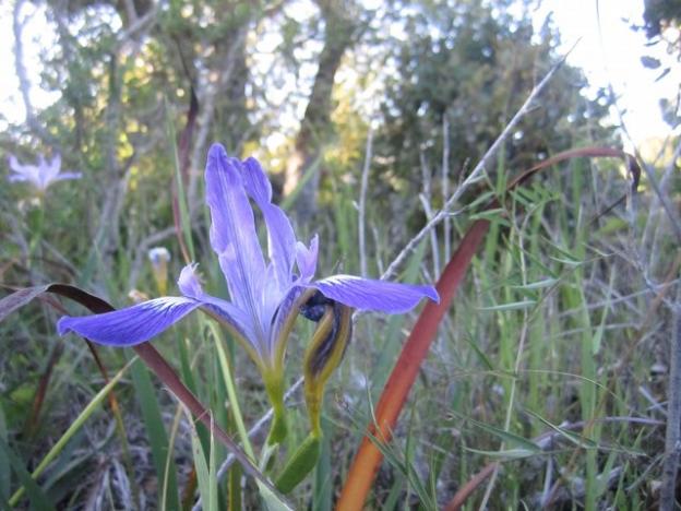
IF YOU’RE LUCKY YOU’LL see a bobcat or coyote, find some blackberries the birds missed, see wild irises blooming in springtime, spot the electric blue tail of a Skilton's skink.
HIKING TRAILS
Old Cove Landing Trail & Ohlone Bluff Trail
3 miles in-and-out; 1 hour; easy
If you’re feeling more ambley than hikerly, or you have little kids along, this is the outing for you.
Engelsmans Loop
3.5 miles; 90 min; moderate
The best little 90-minute hike in the county leads past a corral where Wilder’s fabulous draft horses graze and gains about 500 feet in 1.5 miles.
Wilder Ridge Loop
7 miles; 3 hours; moderate to strenuous
This honker of a loop starts with a hard left up the hill just past the horse corral and soon levels out, passing grasslands with graceful spreading coast live oaks and a big pond where red-winged blackbirds trill away the afternoon.
Chinquapin Trail to Eucalyptus Loop
5.5 miles RT from Empire Grade entrance; 3 hours; moderate
The 1996 acquisition of Gray Whale Ranch gave Wilder Ranch an entrance off Empire Grade Road and presented hikers and bikers with the possibility of having their downhill fun first and ending their day with a long relentless slog up the slope of the Santa Cruz Mountains.
MOUNTAIN BIKING
Thanks to a vocal cycling contingent operating in the county, Wilder is accessible from the city of Santa Cruz via a bike path that parallels Highway One starting at Swift Street on the Westside of Santa Cruz (where, coincidentally, it is not just possible but quite pleasant to fuel up at Kelly’s French Bakery, or what the hell, on organic suds at the Santa Cruz Mountain Brewery or one of a half-dozen wine-tasting rooms there. Oh, wait. We’re not actually recommending drunk mountain biking.). It’s about a 2-mile ride from town to the entrance of the park.
Vista Junkie's Loop
9.1 miles; max elevation 860 feet
With a couple of technical single track sections sandwiched between fire road climbs and open meadow flows, this route delivers what most cyclists came for: couple of sweaty and giddy hours on their bikes.
Rebel's Ride
8.3 miles; max elevation 620 feet
Breaking the rules without breaking the law, this 8.3 mile ride traverses some of Wilder’s most scenic trails in the opposite direction of usual traffic.
Fire Road Fabulous
8.2 miles (or 11.2 with optional UCSC crossover); 1080 feet
This 8.2-mile loop lets you enjoy all the heights of Wilder without the hassle of gnarled roots or technical descents.
High Tech Delite
10.1 miles; max elevation 640 feet
This somewhat advanced 10.1-mile route, which includes the park’s toughest climbs, gives a new definition to “tech-savvy.” It avoids fire roads whenever possible and takes you through Wilder’s most challenging sections.
Coastline Cruise
10.5 miles or as short as you want it to be; flat
If you’re an ocean lover, want an all-day excursion with the family or just don’t like hills, this 10.5-mile round trip journey to Four Mile Beach along the Ohlone Bluff Trail offers the chance to get away from it all at a pace just right for its simple, majestic scenery.
Engelsmans Loop to Long Meadow Trail
8 miles; 1,000 feet elevation gain
Four long miles up, four fast miles down. Or is it the other way around? Whether you start at the Highway One entrance 3 miles north of Santa Cruz at the bottom of the park, or at the Empire Grade entrance about 2 miles past Heller Drive at the East Entrance to UCSC, this combination of trails with its 1000 feet of net elevation gain provides long, swift descents down a fire road and unparalleled views of the bay.
Engelsmans Loop to Long Meadow Trail to Chinquapin Trail to Eucalyptus Loop to Wilder Ridge Loop
9.3 miles
This route almost circumscribes the park. Follow directions for the Engelsman–Long Meadow Trail starting at the bottom, but instead of turning around and retracing your route, take a hairpin left on Chinquapin Trail and follow it through sandhill that gives way to a small scenic meadow and skirts oak woodland to arrive at a stand of massive eucalyptus, site of an old homestead.
SURFING
Four Mile Beach
Consistent waves at a beach on the northernmost end of Wilder Ranch State Park
1401 Coast Rd, Santa Cruz, CA 95060. 831.423.9703. Learn more at the official Wilder Ranch website. Map to Wilder Ranch State Park
Category:


